
Update from the California King Tides Project:
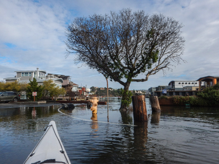
 Check out the online map of the December King Tides photos to get an idea of what one foot higher seas may look like. (As an example, San Francisco is projected to see a rise in sea level between 1.1 and 2.7 feet by 2050.) Learn how to take and upload your photos to the map, and find high tide times near you. Visit your favorite spot, or find a place on our map that doesn’t yet have photos and help us fill in the gaps!
And, of course, on Jan. 21—at peak king tide—our own (floating homes) citizen scientists will be checking the water levels and photographing the results, as measured by yardsticks mounted on various docks around our community. Read more: King Tide Tracking: December Results and How High: Seeking Volunteers to Track Tides
There are some great community events taking place this month—check out the list below to join a local group for King Tides. And on January 21 from 10:30am-11:30am, join California State Parks on their facebook page for a King Tides live stream as they visit six state parks from Laguna Beach to Humboldt.
As always, respect the ocean’s power and be safe, and please don’t disturb shore birds taking refuge in areas above the tide line.
Thank you, citizen scientists! Learn more at california.kingtides.net
- FLOODED WITH SCIENCE AND SEAWATER
Marin County, San Rafael
China Camp State Park
Jan. 21, 11a.m.-1p.m.
Presented by San Francisco Bay National Estuarine Research Reserve and Friends of China Camp
Celebrate winter with a beautiful short hike and lots of science at China Camp State Park! Join scientist and educator Sarah Ferner from San Francisco Bay National Estuarine Research Reserve to learn about the marsh, scientific research occurring there, and what king tides can teach us about sea level rise. Info and registration (required): friendsofchinacamp.org/event/king-tide-hike-2 - A ROYAL WALK WITH THE KING TIDES
San Francisco County, San Francisco
Between Piers 3 and 5 on the Bay side of the buildings
Jan. 21, 10:30a.m.
Presented by the Exploratorium and Port of San Francisco
Join Exploratorium and Port of San Francisco staff for a stroll along the waterfront to observe, photograph and discuss the King Tide. We’ll talk about what causes the tides, why we have King Tides at this time of year, and how to participate in the California King Tides Project. We’ll meet rain or shine. Come see the future! Free. Info: Lori Lambertson llambertson@exploratorium.edu, and www.exploratorium.edu/visit/calendar/king-tide-walk-january-2019
recent & related posts:
King Tide Tracking: December Results
King Tides are Coming
King Tides Project and Upcoming Events
A King Tides Walk and the King Tides Project