Your tide app or chart predicted a 6-foot tide at 8 a.m. this Wednesday, Dec. 19. But maybe you noticed the water seemed higher than that. What’s going on?
Longtime dock residents are well aware that winter storms plus high tides mean predictions may be off by many inches. That’s what happened on Tuesday, Nov. 27, as Supervisor Kate Sears noted. “Tides are currently running about half a foot above predicted levels,” she wrote in her newsletter that day. “Today’s predicted tide was 5.94 at 1:50 p.m.—but the actual high tide was 6.46 feet.”
Sea Level Risk
That same weekend, the United States released a major scientific report with dire predictions: seas may rise sooner than expected. Marin County BayWAVE is researching our sea level risk, especially in Tam Junction, which will be one of the first areas to be underwater regularly. Some people have pointed to our floating homes community as a solution (why not float more homes?), and many of us think we’re safe from flooding. But are we ready?
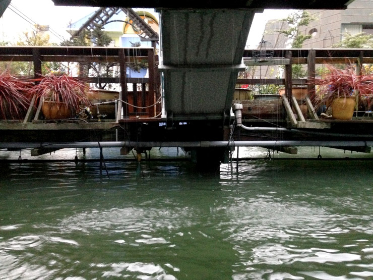
Of the 11 docks here, only two—Commodore and the Charles van Damme—have utilities embedded within their floating docks. The rest of us may have noticed water levels gaining ground on the pipes and wires under our fixed docks.
Resident Volunteers
How close are our utilities to being submerged? What’s important, writes Chris Choo, Marin County principal planner and BayWAVE lead, is “documenting the water level in relation to what is important (utilities, in your case).”
The FHA Environmental Committee is looking for volunteers to serve as citizen scientists willing to monitor a yardstick placed on a dock piling near their home. We need one volunteer each from South 40, Liberty, Main, Issaquah, A Dock, Yellow Ferry, East Pier, West Pier and Gate 6 ½. We will also need helpers to mount the yardsticks.
“When taking photos, make sure to get the entire area, close-ups, and some with anything to show perspective (the yardstick).” ~ Marin County Planner Chris Choo
The King Tides in December and January provide a perfect moment to document some high high tides. Each volunteer will read the height of the water as measured on the yardstick and take several photos at 11:20 a.m. on Sunday, Dec. 23 and at 11:24 a.m. on Monday, Jan 21.
If you’d like to volunteer, email Jen at jengennari@gmail.com with the name of your dock and house number. The deadline to sign up is Saturday, Dec. 22.
Further reading:
King Tides are Coming
The Challenge of Sea Level Rise in Sausalito
Rising Sea: Understanding Impacts to Bothin Marsh