Michael Konrad of South Forty has reviewed a new book with relevance to our community: The Politics of Urban Water: Changing Waterscapes in Amsterdam by Kimberley Kinder.
The author points out that that in Europe, taxes are high, but you get more benefits. It’s old and small, land is valued, cities are often dense with sharp boundaries. They can’t waste much land on suburbs and transition zones; live on it or farm it. Houses are small and more people live in apartments and rent. Refrigerators are small and people shop often in local markets. Cars are small and not as common as in USA. Public transportation is much more developed. People walk, and in Holland everyone has a bicycle.
The Netherlands (lowlands) is very water oriented
Most of the country was originally low marsh land or was reclaimed from the sea bottom. Canals are not just for barge transportation but are needed to carry ground water back to the ocean. Constant pumping is needed to keep the water level low and was originally done by windmills. Holland technically refers to only 2 of the 12 provinces of the Netherlands.
The Netherlands has 18 million people; total area 42,000 square kilometers, of which land is 34,000 square kilometers and the remaining 26% is below the level of the sea. The biggest cities, in order of population, are: Amsterdam (3 million people), Rotterdam (busiest port in Europe), and The Hague (our Washington DC). Compare The Netherlands to California: 39 million people (10 million in SF Bay region) in 424,000 square kilometers of land.
Says Michael:
I will let you use Google Maps to get a detailed map of Amsterdam but my schematic of the city, (below) is less complex and can serve to start our discussion. The center of the city is cradled by four large concentric canals, each made up of straight segments. There are also many radial canals that cross, many narrower, but one much wider. The four blue segmented semi-circles are the main canals that ring the city. Not shown are the many radial canals that intersect these and other canals that connect the system to the IJ Waterway at the top of the frame. It is known for being Amsterdam’s waterfront.

De Oude Kerk, “The Old Church”, is just to the west of the center of the city. It is an imposing wooden structure built just before 1300 and the only large wooden building that survived huge fires in 1420 and 1440. Today it is used for artistic and cultural purposes. Perhaps ironically it is in the center of the red light district.
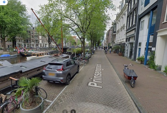
After WWII, housing was scarce, and by the 1960s, many abandoned barges on the canals had become at first temporary, and then permanent, shelters as the owners remodeled them to become comfortable residences. The canals also served as venues for parades and demonstrations. Gay rights advocates frequently organized events and canal boat residents became associated with gays and hippies.
- 1950 400 houseboats
- 1960 1222 houseboats
- 1980 2250 houseboats
This activity stimulated the interest of heritage enthusiasts and real estate agents interested in higher prices. One extreme development proposal was to close off and excavate canals for underground parking space. Water would then be readmitted, but only to a depth of a few feet. This would provide attractive reflections of trees along the canal but be too shallow to allow boat travel which would disturb the image and create noise. However, working class organizations then realized that expensive housing for elites would price them out of the area, and joined forces with houseboat residents to stop the project.
Housing in Amsterdam
Even today there is still less available housing than demand. This imbalance is “solved” by a complex system which has continually changed in its details. In 1901, Dutch housing law made it possible for worker groups to finance construction of blocks of affordable “public housing”. Rents of public housing were low, but there was a long waiting list and you had to work in Amsterdam and have a modest income. There remained a fraction of dwellings that were privately owned and more available but with a much higher rent. Remnants of these public groups still exist but a complex mixture of free-market housing has displaced a large fraction of public housing reflecting changes in the distribution of occupations away from tradespeople toward information and creative workers with higher incomes. In 1995, 58% of housing was public; of the remaining 42% that was private, only a fraction was owner occupied.
- 1995 11 percent owner occupied
- 2002 20 percent owner occupied
- 2009 32 percent owner occupied
The rental price of public housing is set by a detailed formula with amounts for different features, such as size, location, etc. Location, including proximity to water, was allowed to be only a small percentage of the price. However, analysis of prices of private housing show that an attractive view including nearby water can account for up to 25% of the total price.
Developing JAVA Island 1990-2000
Before WWII, goods were carried as break-bulk cargo in small (by today’s standards) ships. This meant that docks and warehouses along waterfronts near, but not actually in, cities were essential transfer centers. The two kilometer-long man-made Java and KNSM islands in the IJ Waterway to the Northeast of Amsterdam played that role (Java was a Dutch colony, KNSM is the Dutch abbreviation of Royal Dutch Steamboat Shipping Co.). Bridges to the island would have impeded ship traffic, so workers commuted by boat. The increase in size of freighters and switch to standardized freight containers which are often stored for extended times near the ships meant that cargo harbors had to be huge. Thus, non-local shipping moved to the nearby Port of Rotterdam and these two islands then became an obvious place to build new housing for Amsterdam.

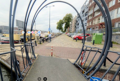
All the decaying warehouses and cranes needed to be demolished, over the objections of artists and other squatters. Some additions were obvious, and bridges and a tunnel to the island for thousands of new commuters were built. Other design parameters were up for grabs. Rumor is that the chief architect went to a Japanese design show and was impressed with arched bridges that he saw. In any case, several canals with arched bridges were cut through the island. To quote the author: “…these new canals became an excellent place to erect expensive housing, adding just the right sex appeal for high end buyers.
Ecologists on Islands; Developing the IJessel Lake region
The two islands and associated docklands on the Southern shore didn’t eliminate the need for more housing, so development moved north-east to the shore of the huge IJessel Lake. The closed-off freshwater lake in the central Netherlands was created by construction of the Enclosure Dam along the shore of the North Sea in 1916 to prevent periodic flooding by ocean storms. Isolated from the salt water, the new lake gradually became fresh from rainwater and the bottom became silted mud due to lack of ocean currents. The silt killed off the extensive beds of shellfish that were food for the water birds.
By the time large scale housing development was considered the public had developed an appreciation for nature, for example birds. Unlike the US, everything is man-made, and there is no actual wild space to preserve. To quote the author “…the notion that Dutch residents live in partnership with the water rather than just protecting themselves from water is a relatively new phenomenon. Thus, developers hired biologists to tell them what the possibilities were and how to achieve them. Their solution was to build small sand dams that generated gentle currents to disperse the silt. Mussels came back, birds followed, the new residents were happy. The houses sold for more money, so the developers were happy.”
Kimberley Kinder is an associate professor of urban and regional planning at the University of Michigan at Ann Arbor. She has a doctorate in geography from UC Berkeley and has written three other books. Her style of narration in this book may seem a little academic (she is an academic after all) and difficult for the lay reader. However, the story is a fascinating, so cut her some slack.
Development on San Francisco Bay
An early surge in development around the San Francisco Bay was created by completion of the Bay Bridge in 1936 and the Golden Gate Bridge six months later. These stimulated housing development for San Francisco commuters in Marine County, Oakland, and Berkeley. Just a few years later WWII caused the population to swell due to shipbuilding and the role of the Bay area as a supply hub for the war effort in the South Pacific.
After WWII, John Reber proposed building large dams across the mouth of the Sacramento River extending South past Richmond and Berkeley in order to supply fresh water to the region and create 81 square kilometers of reclaimed land. The Army Corp. of Engineers built the Bay Model in order to study this plan and predicted it would cost at least ten times the original estimate. The project was canceled. A proposal was made to use rock from the San Bruno mountains to fill in the Eastern edge of the bay along Palo Alto and North to the present San Francisco airport. Another project was to use Brooks Island off of Richmond to fill in that part of the Bay. By these standards our “houseboat wars” in the 1970s in which hippies resisted the construction of the present docks for a decade seem insignificant [see Law vs. Reality at Waldo Point by Charles Bush and Larry Clinton in these pages Nov 22, 2019].
A backlash to huge development projects which would drastically alter the bay shore created an environmental movement and resulted in the creation of the Bay Conservation and Development Commission (BCDC) in 1963, which today evaluates and controls development along the shores of the Bay and the mouth of the Sacramento River. The emphasis now is on preserving the shore as it is or was.
A Floating Homes Takeaway
Development of communities is defined by economic, political, and social forces, sometimes with conflicting goals. Stability of our floating homes community is enhanced by its role as a tourist attraction, which brings visitors to Sausalito who eat at restaurants and buy gifts at stores. This creates advocates for the floating homes in the Sausalito business community and city hall. We should thus welcome visitors to our community even if it may impinge slightly on our privacy.