Climate-induced sea level rise and flooding are expected to have a huge impact on the communities bordering Richardson Bay. To help residents better understand what is being done to prepare for these impacts, the County of Marin and a group of regional partners have created a new interactive website, Richardson Bay Resilience.
Topics covered on the website include:
- flooding today,
- sea level rise projections, and
- recent and ongoing studies from various county agencies.
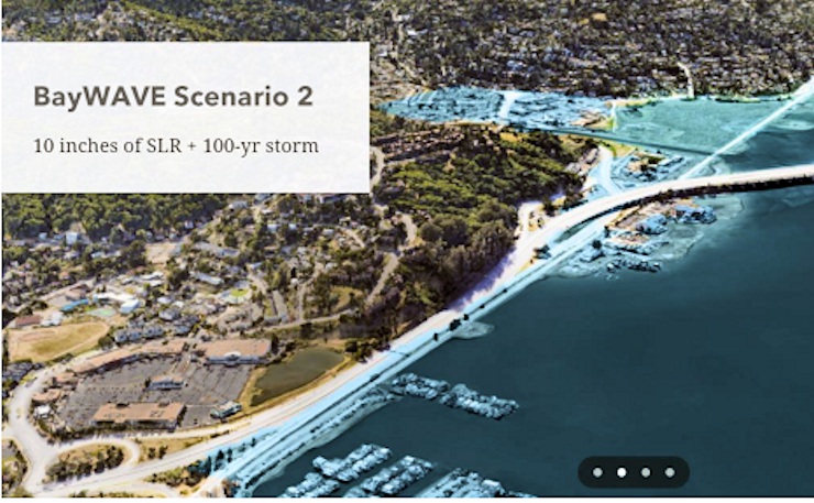
A series of maps features renderings of the effects of various projections of sea level rise plus major storms (scroll down the page to the section entitled “Sea Level Rise Projections”). The illustration above shows the most conservative projection, which models 10 inches of sea level rise and a 100-year storm event. The phrase “100-year storm” refers to the estimated probability of a storm event happening in any given year. A 100-year event has a one percent chance (or 1-in-a-100 chance) of occurring in any given year. It does not mean that such a storm might happen only once every 100 years. Last November we reported that scientists predict sea levels rising 20 inches by 2040; you can see this modeled on the second map in the series as well.
The site also presents potential adaptation strategies for well-known problem areas like Marin City, Manzanita and the floating homes community. Scroll down through the site to take part in a sea level rise survey and to explore other ways to get involved in this process.